|
|
|
|
|
|
|
General Information
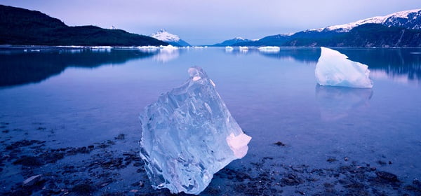
Glacier Bay National Park and Preserve commands a glacier-crowned, maritime wilderness that stretches northward from Alaska�s inside passage to the Alsek River, encircling a magnificent saltwater bay. The 3.3 million acre park derives its name and much of its biological and cultural significance from this great bay, which harbors spectacular tidewater glaciers and a unique assemblage of marine and terrestrial life. To the south and east, the landscape fragments into the timbered islands and winding fjords of the Alexander Archipelago and the Tongass National Forest. To the west, the Park�s pristine outer coast opens to the Gulf of Alaska, and beyond to the Pacific Ocean and Asia. To the north, the St. Elias Mountains reach across the new Tatshenshini-Alsek Provincial Park (British Columbia) to connect two more vast protected areas; Wrangell-St. Elias National Park and Preserve in Alaska and Kluane National Park in Canada. A mountain-guarded, maritime sanctuary, Glacier Bay National Park thus secures the coastal flank of the largest internationally protected area on earth.
Glacier Bay proper opens to the north off Icy Strait and branches for over 60 miles through increasingly deforested mountains to terminate in bare rock and glacial ice. The heart of the present Park, Glacier Bay was hidden under a vast ice sheet when the earliest Europeans paused briefly to chart the adjacent waters in the late 18th century. Eighty five years later, the American naturalist and writer John Muir found the glaciers had receded more than 30 miles, beginning the documentation of one of the most rapid glacial retreats ever recorded. Tlingit oral history along with subsequent investigation have established that this dynamic bay had been ice-free before, and was home to the Huna people who had inhabited it between periodic glacial advances for thousands of years. Since the latest reopening, the glaciers have continued to withdraw, and the land and waters thus unlocked have evolved a diverse array of flora and fauna in an ongoing display of marine and terrestrial succession. These successional processes offered unparalleled opportunity for scientific study, and the resulting attention spurred the move to protect Glacier Bay and its environs as a National Monument in 1925.
The present-day National Park and Preserve, expanded to its current boundaries in 1980, encompasses an extensive and diverse north Pacific coastal biome. Steep, sculpted peaks and scoured, rock-strewn valleys exemplify glacial activity and mark advances and retreats that have occurred since before the Wisconsin ice age. High montane ice fields, expansive river and stream systems and a dozen tidewater glaciers influence the terrestrial and marine environments. The sheltered waters of Glacier Bay ebb and flow with the region�s huge tides, while ocean waves pound the beaches of the wild and remote Gulf coast. Between the bay and the coast, the lofty, snow-clad peaks of the Fairweather Range spawn the Park�s largest glaciers. The mountains that surround the bay descend into newly deglaciated foothills and outwash plains, rapidly turning green as the ice age retreats. A mature spruce and hemlock forest blankets the shorelines and creeps up the slopes of the lower bay. New islands emerge from the waters as the weight of the glaciers lifts from the earth�s mantle, and beaches continue to rise and expand.
Marine waters make up nearly one fifth of the Park, and with no point of land more than 30 miles from the coast, the terrestrial and marine environments are closely intertwined. The proximity of the sea creates the cool, moist climate with abundant precipitation that enhances glaciation and largely defines the biota. The combination of large seasonal runoff and tidal turbulence generates an upwelling of nutrient-rich waters, forming the basis for a productivity that resonates through the entire ecosystem. Stimulated by long hours of spring sunlight, phenomenal phytoplankton blooms nurture krill and other invertebrates. Rich intertidal and subtidal zones establish thriving communities of marine organisms, which expand in complexity as they increase in distance from the glaciers. These food sources are exploited by a variety of animal life, both terrestrial and aquatic, and account for much of the biodiversity found in the Park.
Over 200 species of fish swim in Park waters, including all 5 species of Pacific salmon. Dungeness, king and Tanner crab as well as clams, scallops and shrimp have been harvested by the region�s human occupants for centuries. Intertidal communities include barnacles, mussels, seastars, urchins, sea cucumbers, sea anemones, and a variety of crabs, worms, snails, chitons, and seaweeds. This zone is a significant feeding and refuge area for commercially valuable marine species and an important nursery area for some as well. Many fishes are associated with subtidal benthic communities, and several sustain important fisheries such as Pacific halibut, rockfish, lingcod, Pacific cod, sablefish, and pollock. Small schooling fishes in the pelagic zone include capelin, sandlance, herring, juvenile walleye pollock, juvenile salmonids, and myctophids (lanternfish).
The productivity of these waters is funneled up the food chain by these aquatic prey, and Glacier Bay is an important foraging ground for marine mammals. Several cetacean and pinniped species feed extensively in the bay, including the endangered humpback whale and the threatened Steller sea lion. Thousands of harbor seals breed and nurture their pups on the floating ice in Johns Hopkins Inlet and among the reefs of the Beardslee Islands. Minke and killer whales as well as harbor and Dall�s porpoises feed in the Park�s productive, near-shore waters. Sea otters are colonizing the bay as well as Park waters in Icy Strait and Cross Sound. Many of these marine mammals ply the more turbulent gulf coast waters as well, where they mingle with gray whales and the occasional beluga whale or other cetaceans less common to the region.
Glacier Bay is blanketed with a mosaic of plant life, from a few pioneer species in recently exposed areas to intricately balanced climax communities in coastal and alpine regions. Mosses, lichens, dryas, horsetail and fireweed are among the first plants to appear near the terminus of the retreating glaciers. As soil accumulates, these pioneer communities usually develop into dense thickets of nitrogen-fixing alder and cottonwood, which enrich the soil and provide shelter for other colonizing species. Furthest away from the glaciers in time and space, the lowlands near the mouth of Glacier Bay have become cloaked in spruce and hemlock rain forest and lush, spongy tracts of muskeg. In the surrounding mountains, the alpine hills and meadows are carpeted with thick mats of flowers and heath. All of these communities support expanding populations of animals, birds and insects as the years pass and the ecosystems grow in complexity.
About 220 bird species or over 25% of the total number of species in all of North America have been recorded in the Park. Thousands of seabirds nest on cliffs and rocky shores within the bay or on the Park�s outer coast, where they flock after abundant aquatic prey. Molting or migrating geese and sea ducks find refuge in quiet arms of the bay, and bald eagles nest along much of its shoreline. Such arctic breeders as the arctic tern and parasitic jaeger find barren outwashes perfect for raising their young. Recently vegetated hillsides support great numbers of nesting songbirds, including several neotropical migrants in a mostly predator-free environment.. The shallow waters and gently sloping beaches of the Beardslee Islands are important foraging and breeding areas for shorebirds and waterfowl and a migratory stopover for many species as well.
The Park hosts healthy populations of land mammals. The mountain goat and brown bear, both highly mobile, have roamed the area for thousands of years and were relatively quick to reinvade after the glaciers� retreat. The coyote, moose and wolf have moved in more recently, but are now well established in the Park. Black bears prowl the forested portions of the lower bay, and the blue or glacier bear, a rare color phase of the black bear, makes occasional appearances. The river otter is widespread, along with marten, mink and weasel, while the scarcer wolverine is present though rarely sighted. Lush vegetation and abundant insects have attracted a variety of rodents including marmot, porcupine and several species of voles, shrews and mice. The Alsek River delta is home to lynx, snowshoe hare and beaver, species that have reached the coast from the interior down the river corridor.
Establishment
Glacier Bay became a National Monument on 25 Feb 1925, and was established as a national park and preserve on 02 Dec 1980. It was Wilderness designated on 02 Dec 1980 and designated a Biosphere Reserve 1986 and a World Heritage Site in 1992. Boundary changes: 18 Apr 1919, 31 Mar 1955, 01 Dec 1978.
The father of Glacier Bay National Park was William Skinner Cooper, an ecologist from the University of Minnesota. Mr. Cooper studied the plants that first began growing in the rocky, barren soils uncovered by the retreating glaciers. William Cooper�s plant studies impressed the Ecological Society of America. Eventually with the society�s help Cooper convinced President Calvin Coolidge to proclaim Glacier Bay as a national monument in 1925.
In 1992, the park received greater protection on its northern boundary when the Alsek-Tatshenshini Park in Canada was formed. This new park joined Glacier Bay National Park, Wrangell-St. Elias National Park and Kluane National Park, national parks in Alaska and in Canada, creating the largest internationally protected area in the world. It is the mission of the National Park Service to protect and conserve Glacier Bay�s beautiful scenery and abundant wildlife for future generations to enjoy.
Size
National Park: 3,225,284
Geography
Between 58 and 60 degrees north latitude, is the Glacier Bay region, the margin of North America is thrown into a broad arc of rugged mountain ranges that intermingles with the Pacific is a maze of ice-scoured fjords, valleys, beaches, straits and islands, the whole comprising an amphibious landscape where no point of land or sea is more than 30 miles from a shore.
It is an austere place of big tides, strong currents, fall gales and frequent earthquakes, a landscape of great peaks hard against profound depths, of somber blues, greens and grays only occasionally relieved by the pastels of a grassy meadow or sunset sky. Though perhaps one quarter of the region remains under ice today, glaciers were much more extensive just two centuries ago, and during the last Great Ice Age coalesced into an all-pervasive plateau having the aspect of modern-day Greenland.
The Glacier Bay region can be subdivided into four geographic provinces: Glacier Bay, Icy Strait-Cross Sound, the Outer Coast, and Admiralty Island.
The Glacier Bay Province
The Glacier Bay province includes the present Glacier Bay watershed, plus large peripheral outwash systems at its southern margin that were distributors of glacial melt water at the peak of the Little Ice Age. The Glacier Bay watershed is a vast tract of land and water delimited to the east and north by the Chilkat and Takinsha Ranges, to the northwest by the high crest of the Fairweather Range, and to the west by the peaks and ridges forming the eastern margin of the Brady Glacier. From this peripheral rim a series of lower ridges extend radially inward, defining between them a complex of partially submerged and variously ice-occupied valleys which merge into two fjord systems---Muir Inlet and the West Arm. These in turn coalesce to form the main trunk of Glacier Bay.
Probably because of its funnel-shaped geography, Little Ice Age advances and retreats were magnified compared to other parts of the Glacier Bay region. With the exception of some lowlands at the province's southeastern and southwestern margins, the entire province was under ice or ice-generated outwash about 250 years ago. The retreat since that time has been one of the best-documented in the world. Though ice remains pervasive in peripheral highlands to the north and west, it has bared an extensive series of known-age land and seascapes which have become the premier laboratory in the world for study of ice-recessional phenomena and post-glacial biotic succession.
Wildlife is diverse and locally abundant, varying considerably along the successional gradient. Large concentrations of harbor seals, waterfowl and seabirds, moose and mountain goats lead the list of prominent species.
Except for minor private in holdings and the 18,000 acre Gustavus area, the Glacier Bay province is entirely included within Glacier Bay National Park and Preserve. It is the Park's core area, receiving the vast majority of the Park's visitor and scientific use. It also hosts a variety of fisheries, the most important among them at present being Dungeness crab and halibut.
Park headquarters at Bartlett Cove and the community of Gustavus, in the province's southeastern corner, are the only permanently settled localities. At the peak of the summer season, they may together have a resident and visitor population of perhaps 1,000 people. The great majority of park visits is via cruise ships, which do not disembark passengers on land in the area.
Icy Strait - Cross Sound Province
Glacier Bay is the principal tributary to Icy Strait-Cross Sound, a large passage that links the northern waters of the Alexander Archipelago to the open sea. Secondary inlets join this waterway from the north and south. At its western margin, Cross Sound broadens out into a complex of small fjords and offshore islets that face the open sea.
Icy Strait - Cross Sound and its complex of tributary inlets provide a wide array of open waters and sheltered estuaries with an equally wide array of water depths and bottom types. Consequently the area hosts important concentrations of a variety of marine species, notably halibut, salmon and Tanner crab, humpback whales, harbor porpoises and marbled murrelets. The recently reintroduced sea otter is thriving. Being along the northern terminus of sheltered waterways extending almost unbroken to Seattle, this waterway is a major conduit for animal movements into and out of southeast Alaska waters, as it is for transient vessel traffic as well. These waters have been major commercial fishing grounds for over a century. Sightseeing, sport fishing and ecotourism are rapidly increasing activities.
Mainland portions of the province west of Glacier Bay are at present dominated by the Brady Glacier. Unlike Glacier Bay ice, the Brady is near its Little Ice Age limits, directly covering much land with ice, and indirectly influencing many valleys and inlets around its periphery with outwash and melt water. Other lands in the province have, with minor exception, been uninfluenced by ice for 13,000 years. A rich array of mature plant communities have developed on these older lands, including major tracts of luxuriant old-growth forest that host substantial deer and brown bear populations. Mainland plant communities, though generally younger, are far richer in mammal species, due to the difficulty of crossing the water barrier posed by Icy Strait.
Most of the mainland is in Glacier Bay National Park and Preserve. Most lands to the south, along with islands in Icy Strait and a strip along the Park's eastern margin, are included within the Tongass National Forest. Private lands are extensive around Hoonah and to a lesser degree along Excursion Inlet. Logging is prohibited on protected National Forest lands in the western half and eastern extremity of this province. Nearly every other valley of the remainder of the National Forest has been roaded and logged to some degree. Native corporation lands have been very heavily logged.
The largely Tlingit community of Hoonah, with a population of about 1,000, has traditionally been based on fishing and subsistence gathering. During the last two decades, however, timber harvesting has provided an additional sector to its economy. Primarily during summer, a few hundred people reside along Excursion Inlet. Many of these seasonal residents work at the large fish processing facility. Elfin Cove is a fishing and tourism community of less than 100 people on the southeast margin of Cross Sound.
Outer Coast
This province extends northwestward along the Gulf of Alaska from Icy Point to Yakutat Bay. Riven by the seam between the Pacific and North American plates, it is being rapidly thrust upward by tectonic forces. This results in a landscape laid out in bands parallel to the coast. These bands are described below.
The Fairweather and Saint Elias mountains have been etched by intense glacial erosion into a high, jagged palisade separating maritime lowlands and the Glacier Bay watershed from the continental interior. These great ranges formed the principal source area for Little Ice Age ice, but acted as a barrier for ice flowing seaward off the continent during the Great Ice Ages. Their peaks are still surrounded by extensive ice fields today.
Desolation Valley, lying along the inter-plate rift, intercepts ice from the mountains like a huge gutter and channels it to a few outlet valleys. In several of these valleys, ice reaches to or nearly to the sea, but Lituya Bay is presently almost ice-free.
A foreland of raised marine and river deposits, often cut into striking raised terraces or series of beaches and swales, lies seaward of the high country and between the outlets issuing from Desolation Valley. Much of this country is vegetated with forest and rich wetlands, and crossed by highly-productive streams. These streams as a whole provide some of the most productive fish and wildlife habitat in North America. During the last Great Ice Age, this ice drainage system kept a few lowland areas from being overrun and hence free to host plants and animals, although the climate would have been very severe.
Sandy, wave-pounded beaches are interrupted periodically by glacial deposits where outlet valleys have conducted ice to the sea. To the northwestward, these beaches tend increasingly to trap estuaries behind them. This beach-estuary complex comprises critical habitat for a variety of fish and wildlife, notably brown bears, wolves, waterfowl and salmon.
Shallow inshore seas contain large populations of Dungeness crab and schooling capelin. During migration, large numbers of many bird and marine mammal species move through these coastal waters and the above mentioned beach-estuary complex. Much of the entire Pacific populations of such species as Pacific loons and gray whales pass through the area.
Yakutat Bay delimits the province's northwest extremity. This large glacial fjord was filled with ice about 1,000 years ago, and has been partially occupied by minor advances at least once since then. The Hubbard Glacier at the Bay's elbow has periodically advanced to block the tributary Russell Fjord and create a lake. The most recent episode occurred a decade ago. Yakutat Bay has important halibut and crab grounds, and hosts a large concentration of harbor seals.
Midway through the province, the Alsek River breaches the coastal mountains and flows to the sea, creating a large delta-estuary complex. This area, Dry Bay, with very high salmon fishery values hosts a seasonal human population of a couple hundred people and is managed as a National Preserve where hunting and fishing are allowed to continue under special regulation by the National Park Service. Southeastward from Dry Bay, all lands and most waters out to three miles from shore are part of Glacier Bay National Park and Preserve. Northwestward, most lands are within the Tongass National Forest, though in designations that preclude logging.
The only permanent community in outer coast province is the largely Tlingit village of Yakutat, with a population of about 800. The economy of Yakutat is based largely on commercial fishing, guided sport fishing and hunting, and subsistence, with a growing component of ecotourism. Logging of National Forest lands began about two decades ago, but was not supported by residents and is now administratively designated for other uses.
Admiralty Island Province
Admiralty, second largest island in the massive Alexander Archipelago, dominates the northern half of the Panhandle. The island is more or less half way between Juneau and Sitka. It is 96 miles long, northeast to south, and about 30 miles in width at its widest. It embraces 678 miles of coastline, highly irregular with many bays and estuaries, and a total area of over a million acres or 1,664 square miles.
Dense green spruce and hemlock forests cover much of the island although only about 20 percent of the area is attractive to timber harvesting. Only a few logging scars show, and many old harvest areas are heavily overgrown with second growth. There are broad valley systems that have never been harvested and are, except for occasional windthrows, literally unbroken carpets of green, pristine wilderness. The area is wet (100-inches-plus annually except for "dry" spots like Angoon, in the rain-shadowed lee of snowcapped Baranof Island to the southwest) climax forest in which underbrush and down trees frequently make foot travel difficult.
A spine of mountains runs up the northern portion of the island, where the treeline ends at around 2,000 to 2,500 feet, with dark forests giving way to alpine meadows and twisted little pines and dwarf spruces in a parkland of flowers, lush grasses, ground plants like the dwarf dogwood or bunchberry, heart leaves and other growth on which Sitka blacktail deer grow fat throughout the summer. To the north, this spine tapers needle-like to Point Retreat, a favorite fishing spot.
South of the spine, in the center of Admiralty, a strong geologic contract breaks the continuity of the mountain complex and a vast mid-island lowlands area embraces a myriad of lakes and streams across the island from west to east. the island reaches its greatest width. To the south of the lowlands, mountainous country slopes to bays on both east and west coasts.
The first of June still finds bears coming out of hibernation on the high slopes. The brown bear is prolific on the island. Population estimates are over 1,000 bears or about one bear per square mile--exceeding the number of people living on the island. Admiralty Island accounts for approximately 10 percent of Alaska's population of brown bears.
While bears outnumber people, bald eagles outnumber bears and provide one of the more outstanding features of Admiralty Island, an estimated 2,500 reside on Admiralty Island, more than all bald eagles known to exist in the remainder of the United States. A graphic plotting of nests in the area identified by U.S. Fish and Wildlife Service biologists results in the intricate outlining of the entire island's coastline.
Angoon, Admiralty Island's only permanent community, lies at the entrance to Mitchell Bay on Chatham Strait. Its people are mostly Tlingit Indians, descendants of the tribes that have controlled the Straits for centuries. Access to Angoon is limited to float planes and the Alaska Marine Highway ferry. This physical isolation from other population centers, coupled with the land in which they live, has served to set Angoon apart from other towns in southeast Alaska in terms of culture and lifestyle. Angoon has been called the stronghold of Tlingit culture.
Time Line
1741: Russian explorer Alexei Ilich Chirikof sights the Fairweather mountain range.
1742-1780s: Russian fur hunters probably access the outer Pacific coast.
1750: The Little Ice Age is ending and the glaciers are beginning to retreat.
1778: Captain James Cook of the H.M.S. Resolution names Mt. Fairweather. Also on board are crew members George Vancouver and William Bligh.
1786: French explorer Jean Francois Galoup de LaPerouse enters Lituya Bay. First known white man to land on the outer coast of what is now the park. He purchases Cenotaph Island from the Tlingits and claims it for France. While charting the entrance to the bay twenty-one crewmen are lost.
1794: Captain George Vancouver of the H.M.S. Discovery, along with Lt. Joseph Whidbey, describes Glacier Bay as "a compact sheet of ice as far as the eye could distinguish". Glacier Bay is a mere 5-mile indentation in the coastline.
1796: An English shipbuilder named Shields employed by Alexander Baranov gathers 1800 sea otter skins from Lituya Bay.
1797-1868: Little is known about the Glacier Bay region. From this time on, the recorded history of Alaska up to its transfer to the United States is dominated by Russian influence.
1799: Baranov establishes Sitka as a white settlement and capital of Russian America.
1867: William Henry Seward, Secretary of State, purchases Alaska from Russia for $7,200,000. The deal draws criticism from the press. The New York World declares, "Russia has sold us a sucked orange". Ridiculed as "Seward's Folly" and "Seward's Icebox", acquiring Alaska would later prove to be a wise venture for the U.S.
1874: William Healy Dall, U.S. Coast and Geodetic Survey, aboard the schooner Yukon, anchors in Lituya Bay. Compares the bay to Yosemite Valley in California.
1877: Lt. Charles E.S. Wood climbs northeast of Mt. Fairweather. Probably the first white man in Glacier Bay. He fails to realize the significance of his visit and makes no claim to discovering Glacier Bay.
1879: John Muir records his "discovery" of Glacier Bay. He enters the bay in a dugout canoe guided by Tlingit Indians from Fort Wrangell. Toyatte, a Stickeen nobleman, leads the group. S. Hall Young, a Presbyterian missionary, accompanies Muir. The glacial ice has retreated up into the bay 40 miles from where Whidbey saw it.
1880: John Muir returns to visit Taylor Bay, Dundas Bay and Muir Glacier. He is led by Tyeen, a Tlingit Indian and once again joined by Young. Stickeen, a small dog, becomes part of the expedition.
1880: Captain Lester S. Beardslee, US Navy, names Glacier Bay, charting its ice-free waters for the first time.
1883: Captain James Carroll aboard the mail steamer Idaho, names the inlet and glacier bearing John Muir's name. Eliza Scidmore, an early visitor, reports a salmon saltery, store and trading post at Bartlett Cove.
1884: Captain Carroll pilots the side-wheel steamer Ancon to Muir Glacier. Carroll builds a boardwalk across the moraine to Muir Glacier for tourists. Tours to the glacier last until the 1899 earthquake.
1890: Muir makes his third visit to Glacier Bay. Constructs a cabin at base of Mt. Wright. Makes extensive glacial observations and explains interglacial tree stumps. Climbs and studies Muir Glacier.
1890-1899: Sporadic placer mining takes place in Lituya Bay area. 1896 is the banner year.
1890: Harry Fielding Reid, a geologist with USCGS, measures movements of glaciers and maps positions of glaciers.
1898: The Klondike Gold Rush is underway in Alaska and the Yukon.
1899: The famous Harriman Alaska Expedition visits Glacier Bay and Lituya Bay. It�s prominent members include Muir, Dall, Grinnell, Washburn, Fernow, Gilbert, Keeler, Burroughs, Merriam, Brewer and Edward Curtis.
1899: On September 10 an earthquake centered in Yakutat Bay measuring 8.4 on the Richter scale leaves Glacier Bay choked with ice, due to rapid and extensive glacier calving.
1915 or 1917: James Todd Huscroft arrives on Cenotaph Island, Lituya Bay. For 22 years, he is the only human to permanently inhabit the 150 mile-long coastline from Cape Spencer to Yakutat.
1916: William S. Cooper, ecologist from the University of Minnesota arrives in Glacier Bay. Begins studies of plant succession. He returns in 1921, 1929, 1935 (with W.O Field), 1956 and in 1966.
1922: Cooper suggests national monument status for Glacier Bay to the Ecological Society of America.
1924: April 1, President Calvin Coolidge temporarily withdraws Glacier Bay area at request of Interior Secretary Work.
1924: Joe Ibach stakes two gold mining claims near Reid Inlet.
1925: President Coolidge establishes Glacier Bay National Monument on February 26.
1926: William O. Field, American Geographical Society, begins mapping and photographing terminus positions of glaciers.
1939: Glacier Bay National Monument doubles in size through a proclamation by President Franklin Roosevelt.
1940: Joe and Muz Ibach build cabin in Reid Inlet and continue their gold prospecting and mining there.
1953: Covering 3,593 square miles, the monument is larger than any of the national parks in the U.S. Canadian Pacific Steamship Company brings the first modern cruise ships into the area.
1955: Gustavus forelands and the east portion of Excursion Inlet are removed from the monument. National defense (Gustavus airstrip) and a boundary error (Excursion Inlet) are cited as reasons for the exclusions, although local opposition to the monument was very strong.
1958: An earthquake measuring 8.0 along the Fairweather Fault produces a massive wave, devastating Lituya Bay.
1960s: Cruise ships are now entering Glacier Bay regularly.
1963: Park Superintendent L.J. Mitchell gathers information to re-designate Glacier Bay as a national park.
1966: Glacier Bay Lodge is built. William S. Cooper, "Father of Glacier Bay National Monument," speaks at the dedication.
1980: The Alaska National Interest Lands Conservation Act is signed into law. Glacier Bay becomes a national park now covering 3.3 million acres, much of it designated wilderness. A national preserve is also added, comprising 57,000 acres.
1986: Glacier Bay National Park, along with Admiralty Island National Monument, is designated an International Biosphere Reserve.
1992: Glacier Bay National Park and Preserve, together with Wrangell/St. Elias National Park (Alaska), Kluane National Park Reserve (Canada) and Tatshenshini-Alsek Provincial Park (Canada), becomes part of a 24 million acre World Heritage Site, the largest internationally protected area in the world.
History
Tlingit (pronounced klink-it) Indians and their ancestors inhabited much of what is now Glacier Bay National Park and Preserve, with both permanent and seasonal settlements. Food and other resources were abundant. The small population of Tlingits thrived, living close to the land, and a rich culture developed. Near the end of the Little Ice Age, about several hundred years ago, advancing glaciers forced the Tlingit people to abandon their villages and move to Hoonah, across Icy Strait from Glacier Bay. Today, many Hoonah Tlingits still regard Glacier Bay as their ancestral home, and feel a special connection to it.
In 1794, as the mother ship H.M.S. Discovery, Captained by George Vancouver, lay at anchor in Pt. Althorp, a survey crew under the command of Lt. Joseph Whidbey painstakingly maneuvered their longboats through the ice-choked waters of Icy Strait. The remarkably accurate chart the survey produced shows a mere indentation in the shoreline, "terminated by solid compact mountains of ice," where Glacier Bay is today. The great glacier that filled the Bay was by then in rapid retreat, and was the source of the floating icepack that so hindered Whidbey. Any visitor who came by at the glacial maximum, a few decades earlier, would have found the glacier�s tongue extending out into Icy Strait almost to Lemesurier Island.
Whidbey was not the first to see Glacier Bay; his record includes mention of the natives who paddled out in their canoes from what is now Pt. Carolus to meet his boats and offer to trade. Were these descendents of the people who once lived in the Bay but were forced out by the advancing glacier? Tlingit oral history is corroborated by modern science, it appears that lower Glacier Bay was habitable for many centuries up until about 300 years ago, when a final glacial surge would have forced the human habitants to flee their homeland.
How long they might have been there is unknown. There were people living over 9,000 years ago at nearby Groundhog Bay, but we may never know who they were. A site on Baranof Island shows that people with an unmistakable northwest coast culture have been in the region for at least the last 3,000 years.
Even as Glacier Bay itself lay encased in ice, native people carried on their activities in many places along the nearby coast, places that may have been free of ice for as long as 13,000 years. The oldest known site in Glacier Bay National Park, located in Dundas Bay, is about 800 years old. Natives were at Lituya Bay, on the park�s wild outer coast, to greet Lap�rouse in 1786. Although a series of earthquake-triggered tidal waves, the latest in 1959, devastated most of the shoreline of Lituya Bay, a pocket of undisturbed forest still harbors archeological evidence of their life there.
In 1879, John Muir relied on Tlingit guides when he first visited Glacier Bay, seeking glaciers, adventure and spiritual enrichment. Muir was the first in a long line of distinguished scientists/naturalists to visit the park, perform research, and bring this remarkable area to the world�s attention. Muir was greatly intrigued with the fledgling science of glaciology, and believed that his beloved Yosemite Valley had been carved by ice long ago. He came to Alaska, in part, to witness glaciers in action and substantiate his theory. Largely due to his enthusiastic writings, Glacier Bay became a popular tourist attraction, as well as the focus of scientific inquiries, during the late 1880�s and 90�s.
Muir�s last visit to Glacier Bay was in 1899. He had agreed to join the illustrious Harriman Alaska Expedition somewhat reluctantly, as its grandiose style did not suit him. Assembled by the railroad tycoon Edward Harriman, the expedition brought together an impressive collection of scientists, artists, photographers and writers to explore the Alaska coast, from the southeast boundary all the way to the Seward Peninsula. The expedition members spent five days in Glacier Bay, and collected a wealth of data between memorable adventures.
The age of tourism and exploration in Glacier Bay came to an abrupt halt soon after the Harriman party departed. In September 1899, a massive earthquake shattered the Muir Glacier. Masses of floating ice prevented ships from closely approaching the glacier for at least a decade, and the steamship companies removed Glacier Bay from their itineraries. Over the next few decades Glacier Bay belonged to a hardy assortment of scientists and adventurous entrepreneurs, as well as native seal hunters, fishermen and egg-gatherers. A number of colorful characters, including the gold miners Joe and Muz Ibach of Reid Inlet and the hermits Jim Huscroft of Lituya Bay and Buck Harbeson of Dundas Bay, enlivened the local landscape.
In addition to rugged individualists who pursued mining, trapping, homesteading, fox-farming and other small-scale ventures, there was at least one successful corporate operation within what is now Glacier Bay National Park, a salmon cannery at Dundas Bay. Relying on a mixture of native, white and Chinese labor, the cannery was a large and prosperous operation between 1900 and 1931, when the general lower demand and prices paid for salmon because of the Great Depression resulted in its closing. During the early 1940s, most of the structures associated with the cannery were dismantled, since the site had by then been included in the national monument.
Scientific interest in Glacier Bay remained high in the years following Muir and Harriman. One of the scientists was also a visionary. William S. Cooper, a plant ecologist studying the return of plant life to the recently de-glaciated terrain, made numerous trips to Glacier Bay beginning in 1916. Enthralled with the beauty of the area, he convinced the Ecological Society of America to spearhead a campaign for its preservation. These efforts met with success in 1925, when President Calvin Coolidge signed the proclamation creating Glacier Bay National Monument, an area less than half the size of the present park. The proclamation cited the features and values of the area: tidewater glaciers in a magnificent setting, developing forests, scientific opportunities, historic interest and accessibility.
Creation of the new monument meant the prohibition of most forms of commercial or extractive activities�and inevitable conflicts with local people, both native and white. Although mining was originally disallowed, Franklin Roosevelt was convinced to open the monument to mining in 1936. Sporadic gold-mining occurred until passage of the Mining in the Parks Act in 1976 (one very significant claim�a nickel-copper deposit beneath the Brady Glacier�remains in private hands and may one day be developed). Conflicts with other human uses were most apparent after the Monument boundaries were expanded�more than doubling its size--in 1939. With the expansion, which had been eagerly sought by the Park Service mainly because of the wildlife habitat that would be preserved, Glacier Bay became the largest unit of the National Park system (a distinction it has since lost, although it is still larger than any park outside Alaska).
Commercial fishing was allowed to continue in the newly expanded monument, although there was actually no legal basis for it. Native seal hunting, a contentious issue for decades, was finally terminated in 1974. A number of fox farmers, and especially the homesteaders at Gustavus, who had settled starting in the 1910s and 20s, unhappily found themselves included within the expanded Monument in 1939. Resolution of most local conflicts, however, was put on hold over the next few years as World War II came to Alaska.
World War II changed the face of Alaska and Glacier Bay, essentially ushering in the modern world to this remote region. In 1941 an airfield and associated facilities were constructed at Gustavus. An even more ambitious�and highly secret�project began in August 1942, two months after a Japanese fleet launched an attack on the American military base at Dutch Harbor. This was construction of a huge supply terminal at Excursion Inlet, just east of the monument boundary. Completed in November 1943, the terminal covered more than 600 acres and included over 800 buildings and three large docks. Fortunately or unfortunately, the main theater of war operations had by the time of its completion moved beyond Alaska, and the facility was used for only a few months. In June 1945 700 German POWs were shipped to Excursion Inlet to dismantle the terminal. Some of the salvaged material was used to help rebuild the village of Hoonah, which had suffered a devastating fire in June 1944.
Turned over to civilian use following the war, the Gustavus airfield proved to be a windfall for both the monument and the local economy. Prior to the war, Park Service planners had envisioned a lodge and administration area at Sandy Cove, accessible only by boat. Now Bartlett Cove, which could be linked to the new airport by a few miles of road, became the focus of development plans. Vociferous appeals from local homesteaders, as well as support from national conservation organizations, resulted in the removal of more than 14,000 acres of land, including the Gustavus airport, from the monument in 1955.
Post-war prosperity and pride, and a burgeoning interest in outdoor recreation, led to a new initiative to develop the nation�s parklands for visitor use. In 1956, NPS director Conrad Wirth announced Mission 66�a ten-year program of planning and development for national parks, timed to reach culmination on the fiftieth anniversary of the founding of the Service. Glacier Bay was an eager recipient of Mission 66 dollars, which funded construction of the lodge (which opened on schedule in 1966), as well as the dock, employee residences, an administration building and other facilities at Bartlett Cove.
For decades there had been talk of elevating Glacier Bay�s status to that of national park. The Alaska National Interest Lands Conservation Act of 1980 finally achieved this goal, and also extended the park boundary northwest to the Alsek River and Dry Bay. Further protection and recognition of Glacier Bay�s significance occurred in 1986, when the Glacier Bay-Admiralty Island Biosphere Reserve was established under the United Nations Man and the Biosphere Program. In 1992 Glacier Bay became part of an international World Heritage Site, along with neighboring Wrangell-St. Elias National Park and Canada�s Kluane National Park.
In the nearly 75 years since Calvin Coolidge took up his pen, the forces of controversy and compromise have forged a mature national park, which nonetheless continues to evolve. The national and global significance of Glacier Bay has been well established, and its preservation assured. But the devil is in the details. The human drama of the park has always focused on finding an equitable balance among three potentially conflicting arenas: preserving this irreplaceable treasure "unimpaired for the enjoyment of future generations", defining and accommodating legitimate local uses, and providing for the needs of the visiting public.
Tlingit Indians were the original inhabitants of Glacier Bay and still consider it their ancestral home. Hunters and gatherers of salmon, seals, berries and roots, they were driven from the bay by advancing glaciers during the Little Ice Age. Naturalist and adventurer John Muir is credited with discovering the bay in 1879, and tourism to this land of ice and snow began soon after. Pioneering homesteaders began farming in Gustavus around 1923, when fish canneries and salteries dotted the region.
Though a few hardy men and women have chosen to live in Glacier Bay and on the outer coast in times past, the area remains largely isolated and undeveloped.
Enter Glacier Bay and you cruise along shorelines completely covered by ice just 200 years ago. Explorer Capt. George Vancouver found Icy Strait choked with ice in 1794, and Glacier Bay was a barely indented glacier. That glacier was more than 4,000 feet thick, up to 20 miles or more wide, and extended more than 100 miles to the St. Elias Range of mountains. But by 1879 naturalist John Muir found that the ice had retreated 48 miles up the bay. By 1916 the Grand Pacific Glacier headed Tarr Inlet 65 miles from Glacier Bay's mouth. Such rapid retreat is known nowhere else. Scientists have documented it, hoping to learn how glacial activity relates to climate changes.
Geology
The Glacier Bay region's extreme topography indicates a landscape driven by immense energies, which derive from the area's position astride the active suture between the North American and Pacific plates. For over 100 million years, North America has been plowing obliquely into the Pacific plate, presently at a rate of several centimeters per year. Generally, the Pacific plate has been forced under North America, but occasional bits,island arcs, pieces of sea floor, fragments of continental margin, have been scraped off one plate or the other, shattered, and smeared along the leading edge of North American plate. Four such terranes have accumulated in a largely northwest-southeast pattern to form the Glacier Bay region.
The seam between the outboard-most terrane and the present continental margin remains active. Frequent earthquakes dramatically illustrate that plate motions continue to this day. The resulting compressional motion has forced some rocks upward to form mountain chains. Others are forced downward and melted in the process. Molten rock then moves volcanically through the shatter zone, where it cools and welds together one of the world's most complex geological jigsaw puzzles.
Highlands forming by this process intercept the predominantly onshore flow of Pacific air, wringing out its abundant moisture in the form of rain and snow. For at least seven million years, snows have accumulated in the uplands to form glacial ice, which has invaded the lowlands many times as the climate has periodically cooled. During the height of the most recent of these Great Ice Ages about 20,000 years ago, an ice sheet covered all of the Glacier Bay region except the highest peaks and certain headlands. Then it would have been possible to walk from Glacier Bay to Cape Cod without ever getting off the ice.
Post Ice Age History
By 13,000 years ago, retreating ice revealed a scoured landscape of rounded hills and deep, U-shaped valleys and fjords. The precipitous peaks in this landscape were taller than the maximum ice depth, thus escaping its erosive action. The land was devoid of valley sediments and pushed down several hundred feet by the weight of the ice. This in combination with higher sea levels, resulted in the land being even more insular than at present. A few species enduring arctic conditions at the glacier margins may have survived to recolonize the emerging land.
For the most part, however, life had to return from afar, slowly surmounting the physical barriers of saltwater, mountains and remaining ice fields, and the ecological barriers posed by the still-harsh living conditions.
Studies of pollen buried in lake sediments and bogs have provided a detailed record of the recovery of plant communities after the ice. For several millennia, tundra and pine-alder scrub dominated the post-glacial landscape. By 9,000 years ago, spruce-hemlock forests had come to predominate, suggesting that by then the climate was approaching the present wet and mild conditions. By 5,000 years ago, peat lands were forming along Icy Strait and glaciers were beginning to advance again into upper Glacier Bay.
All the while, the physical landscape was undergoing changes of its own. Post-Great Ice Age rebound, mountain-building and accumulation of sediments brought down from the uplands began extending valley bottoms at the expense of fjords and connecting islands to the mainland. Where these sediment met the sea, waves and currents worked them into beaches and estuaries.
Conditions for immigration and establishment of land and freshwater animals were improving, while breeding sites for colonial birds and marine mammals probably became fewer. We can imagine the salmon colonizing valley streams, and forest species like deer and black bear becoming ever better established, while puffins and sea lions diminished. As of now, this story is very sketchily known, but deposits of animal bones in recently-discovered caves in southern southeast Alaska have begun to provide a more detailed record of mammal and bird reoccupation of the land. This cave topography extends into the Icy Strait province, where it remains almost totally unexplored at present.
Climatic influences
Glaciers grew in response to climatic severity. When glaciers dominated the land, they tended to worsen harsh climatic conditions by reflecting heat rather than absorbing it. This generated cold high-pressure cells in the atmosphere that held the warm oceanic air at bay. By contrast, today with glacial ice at a relative minimum, we live in a period of greater than average mildness. The large, low pressure systems sweeping off the Gulf of Alaska are now the dominant force in the climate, bringing with them the abundant moisture for which southeast Alaska is infamous. Since oceanic currents in the Gulf of Alaska are mostly from the south, southeast Alaska is bathed by warmer waters than is customary for its latitude, so temperatures are particularly mild on average.
The sea's moderating and humidifying influence pervades the region as a result of the penetration of marine channels and bays, with the greatest influence being along the outer coast. Closer to the continental interior, especially near major passes, periodic influences of continental air reduce the average rainfall and bring more extreme seasonal temperature variations.
Glaciers
Worldwide, the glacial facts are staggering. Glaciers and polar ice store more water than lakes and rivers, groundwater, and the atmosphere combined. Ten percent of our world is under ice today, equaling the percent being farmed. If the world's ice caps thawed completely, sea level would rise enough to inundate half of the world's cities. The Greenland and Antarctic ice caps are 2 miles thick. Alaska is four percent ice.
Glaciers form because snowfall in the high mountains exceeds snowmelt. The snowflakes first change to granular snow, round ice grains, but the accumulating weight soon presses it into solid ice. Eventually, gravity sets the ice mass flowing downslope at up to seven feet per day. The park includes some 12 tidewater glaciers that calve into the bay. The show can be spectacular. As water undermines some ice fronts great blocks of ice up to 200 feet high break loose and crash into the water. Johns Hopkins Glacier calves such volumes of ice that it is seldom possible to approach its ice cliffs closer than about two miles. The glaciers seen here today are remnants of a general ice advance, the Little Ice Age, that began about 4,000 years ago. This advance in no way approached the extent of continental glaciation during Pleistocene time.
The Little Ice age reached its maximum extent here about 1750, when general melting began. Today's advance or retreat of a glacier snout reflects many factors: snowfall rate, topography, and climate trends. Glacial retreat continues today on the bay's east and southwest sides, but on its west side several glaciers are advancing.
The snowcapped Fairweather Range supplies ice to all glaciers on the peninsula separating Glacier Bay from the Gulf of Alaska. Mount Fairweather, the range's highest peak, stands at 15,320 feet. Near Johns Hopkins Inlet, several peaks rise from sea level to 6,520 feet within just 4 miles of shore. The great glaciers of the past carved these fjords, or drowned valleys, out of the mountains like great troughs. Landslides help widen the troughs as the glaciers remove the bedrock support on upper slopes.
Huge icebergs may last a week or more, and they provide perches for bald eagles, cormorants, and gulls. Close by, kayakers have heard the stress and strain of melting: water drips, air bubbles pop, and cracks develop. Colors betray a berg's nature or origin. White bergs hold many trapped air bubbles. Blue bergs are dense. Greenish-blackish bergs may have calved off glacier bottoms. Dark-striped brown bergs carry morainal rubble from the joining of tributary glaciers or other sources. How high a berg floats depends upon its size, the ice's density, and the water's density. Bergs may be weighed down, submerged even, by rock and rubble. A modest looking berg may suddenly loom enormous, and endanger small craft, when it rolls over. Keep in mind that what you see is "just the tip of the iceberg."
Whales
Whales, symbolizing the struggle to preserve nature, include the largest creatures our world has known. Blue whales weigh up to 140 tons. Sixty to 100 million years ago the ancestors of today's whales were land-dwelling, warm-blooded, air-breathing mammals who successfully returned to the seas to live. Alaskan waters boast ten species of baleen whales and five toothed whales. Glacier Bay waters include baleen whales, the minke and humpback, and one toothed, the orca. The whale's appeal mixes familiarity and strangeness. Whales often live in family groups, aid each other in distress, and communicate with each other. Many observers credit whales with rational thought.
Minke whales are thought to be quite migratory and are more at home in cold northern waters than most baleen whales. (Baleen whales are named for how they feed, which is described below, under the entry for humpback whales). Cod and pollock are their main diet here. Farther south, minke favor krill. The upper size limit of minke whales in northern waters is 33 feet. Among large whales, minke are fast swimmers, making speeds up to 20 miles per hour. As whaling has depleted more favored species, the rich-meated minke has become the most heavily taken of the baleen whales today. The North Pacific population appears to have declined to between one-forth and one-third its pre-whaling numbers.
Orca whales feed on various marine animals, including fish, sea lions, seals porpoises, sharks, squid, and other whales. Also called killer whales, orcas can hunt in teams and have killed blue whales, the world's largest animal. Male orca whales average about 23 feet long; the females less. They have no natural enemies. Thought to be highly intelligent, orcas are readily trained in captivity. They can swim at a steady 29 miles per hour. Their distinctive, large triangular dorsal fin may reach nearly 6 feet high in old males.
Humpback whales are the most acrobatics of whales, heaving their massive bodies by leaps and turns out of the water. Humpbacks are both cosmopolitan - found in all oceans - and endangered. Only about seven percent of their pre-whaling numbers remain. Coastal feeders who love shorelines, bays, and fjords, they are naturals for Alaska, which boasts nearly 34,000 miles of tidal shoreline. Humpbacks feed here on krill, shrimp, and various fish including capelin. Humpbacks feed heavily because, unlike most birds and mammals, they do not feed year round. Humpbacks must store enough fat in summer to last the rest of the year. Adults average 40 to 50 feet long, females being the larger. Adults weigh in at about three-quarters of a ton per running foot.
An adult humpback has from 600 to 800 baleen plates in its mouth. These plates end in bristles. In the feeding process, huge masses of sea organisms are scooped into the mouth. Then the water, some 150 gallons at a shot, is expelled while the plates filter in the edibles. Were you to stare into a humpback's mouth, which opens to 90 degrees, you might not readily discount the Biblical mishaps of Jonah.
Glacier Bay humpbacks have been observed working singly or in pairs to cast a "net" of bubbles about their prey and then harvesting the hapless creatures, probably shrimp and other slower moving organisms, caught in their airy illusion. To see these large whales in their native habitat surely counts as one of the great experiences of a lifetime. The situation of whales, particularly of the endangered humpback whales, in Glacier Bay has recently been under intensive scrutiny by scientists. The purpose of the studies has been to learn enough about these awe-inspiring creatures to protect them. The numbers of whales present can vary dramatically from year to year. Whether these variations are wholly natural or not is uncertain. Historically, most of the available information about whales derives from attempting to hunt them, not to save them from extinction.
Each summer 15 to 20 humpback whales regularly feed in park waters, concentrating in the lower part of the bay. They migrate here from their winter home in the warm waters off Hawaii and can often be seen along the shorelines of Southeast Alaska. Special regulations go into effect when large concentrations of whales are in the park. The regulations affect vessel speed limits and travel routes in certain areas.
Flora
There are approximately 420 species of plants found in the park. Some of the most common ones include horsetail, fireweed, blueberry, alder and willow. Trees found in the park are cottonwood, Sitka spruce, lodgepole pine, western and mountain hemlock.
Scientists and other observers came to Glacier Bay to see the great glaciers and found here the ideal natural laboratory for the study of plant succession. How do plants recover a raw landscape? What happens when nature wipes the slate clean and starts over from scratch? Glacier and plant studies go hand in hand. Rapid re-vegetation following the glaciers' speedy retreat has enabled us to map and photograph the course of plant succession. When naturalist John Muir came to Glacier Bay in 1879 he was seeking corroboration of the continental glaciation theories of Louis Agassiz, whose controversial Etudes sur les Glaciers was published in 1840. Here, in the aftermath of retreating glaciers, Muir found a landscape not yet formed.
Today at Glacier Bay a vegetative wilderness is being created, culminating in coastal forest. A trip up bay mimics glacial retreat and rolls back plant succession, from the mature forest at Bartlett Cove to the naked Earth structure at the fjords' farthest reaches. Biological succession produces profound change here in a mere decade. Early, long-range studies of plant succession began in Glacier Bay in 1916, with the work of Professor William S. Cooper. His plant studies were continued in 1941 by Professor Donald Lawrence and others.
Plant recovery may begin here with no more than "black crust", a mostly algal, felt like nap that stabilizes the silt and retains water. Moss will begin to add more conspicuous tufts. Next come horsetail and fireweed, dryas, willows, alder, then spruce, and finally hemlock forest. In many areas the final or climax stage of plant succession may be the boggy muskeg, but this may take hundreds of years to develop, after the establishment of hemlock-spruce forest. Where plant's seeds happen to land can be critical. The chaotic rock-and-rubble aftermath of a glacial romp is deficient in nitrogen. Alder and dryas are important pioneers because they improve the soil by adding nitrogen to it. Much of northern Europe and America were pioneered by dryas when the last Ice Age ended. Sitka alder begins to form dense entanglements that are the bane of hikers. Spruce takes hold and eventually shades out the alder. A forest community is begun. Each successive plant community creates new conditions. The theory holds that plant competition modifies the environment,light and moisture availability, and soil nutrients, so that plant populations also change. Over time, successive plant communities will occupy the environment, hence plant succession. The time from naked rock to revegetation is not necessarily long.
The majority of visitors view the park by cruise ships. Ship entries are limited to 139 through the summer to help protect endangered humpback whales which use the park waters. A smaller number of visitors see the park in smaller power boats or by kayak. When English explorer George Vancouver sailed through Southeast Alaska about 200 years ago, he charted only a small recess in the shoreline in the place where Glacier Bay is today. The "solid mountains of ice rising perpendicularly from the water's edge" that he described have retreated more than 60 miles and opened a vast bay to the sea. What was bare rock at the edge of the ice in Vancouver's time is now lush rain forest with huge Sitka spruce.
Up bay, where the ice has departed in the past few decades, low plants are beginning to take hold. And at the end of the bay, tidewater glaciers still present solid mountains of ice.
Wildlife
The distribution of non-marine animals is more complex than that of plants. Not being rooted in place, animals can roam through various plant communities. Birds and many flying insects are especially mobile, and so are able to overcome most physical barriers. But they are particular about habitat choice, and most are associated with a certain group of plant communities. Animals of this type tend to be more widely distributed, but are found in specific habitats.
The opposite tends to be true for mammals. The largest species often use a variety of habitats from the beach to the alpine. Yet because many mammals lack a dispersal phase in their life history comparable to the mobile seeds or spores of plants or the winged migrations of birds, their large-scale distribution is relatively incomplete.
For instance, of the approximately 48 mammal species living in the interior of British Columbia with ranges bordering on our region, only about 29 have made it across the mountain passes and become established at Haines. Only about 11 of these have made it past the water barriers to Chichagof Island. This excludes the marten, red squirrel, mountain goat, and feral dog, which were introduced by people. The relatively few land-based animals able to colonize the extremities of our region have often attained large numbers. Among these are bears, deer, mink and otter. See the checklist of mammals found below.
In the summer breeding season, 230 birds call Glacier Bay home. Land birds include the rufous hummingbird, ruby-crowned kinglet, hermit thrush, chestnut-backed chickadee, blue grouse and hairy woodpecker. Sea birds and shore birds include the black-legged kittiwake, tufted puffin, pelagic cormorant, pigeon guillemot, arctic tern and the black oystercatcher. Numerous bald eagles build their nests in spruce and cottonwood trees. Some eagle nests can reach seven feet across. Where trees are not available eagle nests are built on the ground or on a cliff ledge.
Only two fishes with no connection to salt water, round whitefish near Haines and northern pike near Yakutat--have made it to the fringes of this region. The bulk of freshwater fishes are salmon and char, which spend parts of their life cycles in salt water, and so can get past the mountains and marine channels that limit the distribution of strictly freshwater animals. Most of the region's streams, even most of those directly under glacial influence, contain spawning and rearing salmon. Some, such as the Situk and Alsek Rivers, are of world-class importance. These major river systems are in the minority. More salmon transit through the region's marine waters than spawn in the region's streams.
A fortunate combination of characteristics make seas of the Glacier Bay region immensely productive. The waters are warmed and enriched by waters from the adjacent Pacific Ocean, then further fertilized by nutrient runoff from the land. Complicated shoreline and bottom topography combine with exceptionally high tidal energies to produce strong currents that stir nutrients to the surface. Two other factors are necessary to translate nutrients into productivity,enough light for plant plankton to photosynthesize rapidly, and enough water column stability to allow these tiny organisms to stay in the zone of light near the surface. All these factors come together in spring and early summer.
Then, for a few weeks, the concentrations of plant plankton reach astronomical proportions. Many animal plankton (e.g., krill, copepods) and bottom-dwelling invertebrates (e.g., starfish, sea urchins, worms, and clams) time their reproduction to coincide with this brief time of plenty. Vast shoals of small fishes such as herring, capelin and sand lance in turn feed upon this animal plankton. Salmon, sea lions, porpoises, cormorants, and murrelets forage on the fishes, while humpback whales come from Hawaii and Baja California to harvest small fish and the plankton by the ton.
Seaweed and salt-marsh vegetation also begins to grow in early spring. They support an abundance of grazers, from deer and geese (at low tide) to snails (at high). When this vegetation decomposes, it produces detritus for bottom-dwellers like worms and sand fleas.
Summer in the upper waters is a brief but exuberant season. Hordes of migrants arrive to join the winter holdouts in harvesting the bounty. Most marine birds and mammals raise their young and then put on fat while the good times last. Fishes exhibit a variety of reproductive strategies. Herring and cod release eggs that hatch into larvae which fend for themselves in the rich plankton soup. Skates produce large yolk-rich eggs produced from stored energy from the previous season. Ling cod males utilize stored energy reserves to defend their brood of eggs from predation.
As the snows and gales of winter come, and the sun moves ever lower in the sky, much of the marine world goes "on hold". Many species leave for the south or the warmer temperatures of the open sea. Most of the rest curtail their activity. Salmon eggs rest in creek gravels. Herring and rockfish school in a rocky deep to await the coming of spring when the drama will be replayed.
But the marine ecosystem does not grind to a halt over winter. A portion of the living matter from upper waters makes its way to the bottom in the form of detritus, where it is eaten by filter feeders such as barnacles, anemones and clams. What they miss is incorporated into bottom sediments to be eaten through the year by tiny crustaceans and worms. These in turn feed flounders, crabs, cod and diving birds such as scoters. Seals, sea otters and flounders provide the next link in this benthic food chain, which fluctuates much less through the seasons than that of the open waters, and thus becomes disproportionately important during winter.
Marine productivity comes ashore in numerous ways. Salmon carry it to the far corners of the region when they spawn. The young of some species remain in ponds and streams, where they are important food for mergansers and kingfishers. Eagles, otters and mink hunt at sea and carry their catch to land.
Most important, shores provide hundreds of miles of interface between land and sea. They provide thoroughfares and den sites; carcasses wash up on them; and they grow lush intertidal communities that are dry land when the tide is out. A large array of predators and scavengers from bears to shrews and ravens patrol the beaches, eating flotsam and some of the intertidal invertebrates. Herbivores like deer, moose, mountain goat, porcupine and voles graze on plants of the upper intertidal zone or eat kelp for salt.
As vegetation develops, so does animal habitat. Mammals move in from populated areas nearby as access routes become available.
The patterns by which animals re-inhabit the land after glaciers retreat are not as neat as with plant succession. There are no true pioneer species paving the way for succeeding species. Land mammals must either walk or swim. They cannot, as plant seeds and spores do, hitch rides on wind and waves or with birds. Extensive water, ice, or mountains loom as impassable barriers. Low mountain passes are often the conduits through which land mammals begin to repopulate the park. Usually they will live off this young terrain only part of the year at first. Then resident populations may gradually build. The process of colonization at Glacier Bay and throughout Southeast Alaska is somewhat hindered by the fact that mammals in general have not had enough time since the Wisconsin Ice Age wound down to re-colonize the land.
Glacier Bay is a land of intense beauty, from its calving glaciers and floating icebergs. From its highest peak, Mount Fairweather at 15,320 feet down to the Bay waters. Bears, river otter, and mink can swim around ice and open water barriers to recolonize uncovered land as the glaciers retreat. Mountain goats and hoary marmots can live on high ridges the ice exposed early in its retreat. Whales, Dall porpoises, and harbor porpoises find open marine corridors to the tidewater glacier fronts. Harbor seals pup on densely packed icebergs. All these animals are widespread in the park.
The patchwork of evolving ecosystems in Glacier Bay and on the outer coast, on surfaces of differing age, elevation and exposure, produces an uneven, dynamic distribution of land mammals. Further, a wide variety of marine habitats exist within the Park. In combination, these factors contribute to the exciting diversity of mammals within Glacier Bay.
Wildlife in the park that is threatened or endangered include the humpback whale (endangered), Steller sea lion (threatened), peregrine falcon (endangered), and the spectacled eider (threatened). The National Park Service works hard to protect and restore habitat important to wildlife so that populations can be healthy and plentiful.
Mammal List
Shrew Family - Soricidae
Plain Nose Bat Family - Vespertillionidae
Bear Family - Ursidae
Weasel Family - Mustelidae
Dog Family - Canidae
Cat Family - Felidae
Sea Lion Family - Otariidae
True Seal Family - Phocidae
Squirrel Family - Sciuridae
Mouse Family - Cricetidae
Porcupine Family - Erethizontidae
Beaver Family - Castoridae
Rabbit Family - Lagomorpha
Deer Family - Cervidae
Goat Family - Bovidae
Dolphin Family - Delphinidae
Gray Whale Family - Eschrichtiidae
Finback Whale Family - Balaenopteridae
Copyright © 1995 - 2007 Hillclimb Media
Click Here to obtain Advertising Information on this Page
This site is in no way associated with the United States Government, the Department of the Interior or the National Park Service
